Last Updated on March 5, 2026 by Admin
It is a practical interview-prep guide designed for civil engineering students, freshers, site engineers, planning engineers, survey engineers, and geospatial-focused professionals preparing for technical interviews in 2026. GIS (Geographic Information Systems) and remote sensing are increasingly used in infrastructure planning, surveying, route alignment, flood mapping, utility mapping, and asset management, making these questions highly relevant to modern civil engineering roles. Esri defines GIS as technology used to create, manage, analyze, and map data, while USGS and NASA describe remote sensing as acquiring information about Earth/features from a distance using sensors on satellites, aircraft, and other platforms.
If you are preparing for GIS interview questions for civil engineers, remote sensing interview questions for civil engineers, or geospatial analyst interview questions for civil engineering, this guide will help you answer confidently with clear technical explanations and civil project examples.
Table of Contents
Why GIS & Remote Sensing Matter in Civil Engineering Interviews in 2026
Construction and infrastructure employers increasingly expect civil engineers to understand spatial data, mapping workflows, and field-to-office geospatial processes. On ConstructionPlacements, GIS has already been covered as a key construction technology area, and related interview-prep content (surveying, BIM, digital twin) also reflects the shift toward data-driven project execution.
Typical roles where these questions appear: Survey Engineer, GIS Engineer, Junior GIS Analyst, Planning Engineer, Highway/Infrastructure Design Engineer, Water Resources Engineer, Environmental Engineer, BIM-GIS Coordinator, and Digital Construction/Asset Information roles.
How to Use This List (Important)
For each answer below, do not memorize only the definition. In interviews, give:
- A clear concept explanation
- A civil engineering example (road, drainage, utilities, site planning, flood mapping, etc.)
- The practical value (time, cost, safety, quality, coordination, compliance)
- The software/workflow context (ArcGIS, QGIS, GNSS/GPS, drone data, satellite imagery, DEM, etc.)
Pro tip: If you are also preparing for broader construction-tech interviews, see these related guides on ConstructionPlacements: 120+ Surveying Interview Questions & Answers 2026, 100+ BIM Interview Questions & Answers (2026), and Top 30 Digital Twin Interview Questions for Construction Professionals.
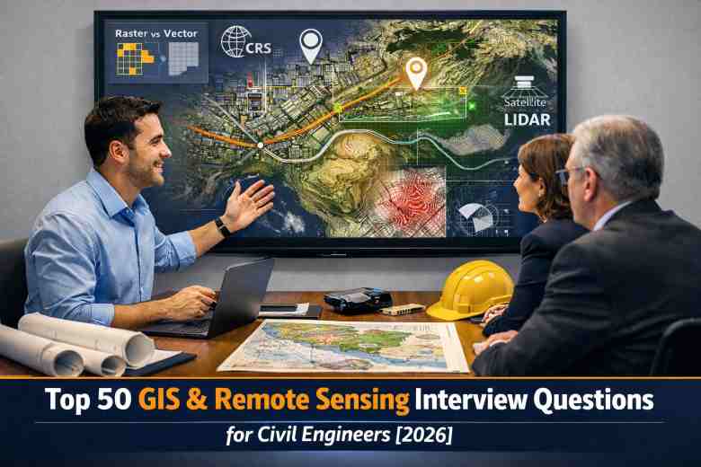
Top 50 GIS & Remote Sensing Interview Questions for Civil Engineers [2026] (With Easy Explanations)
Section A: GIS Fundamentals (Questions 1–10)
1) What is GIS?
Answer: GIS (Geographic Information System) is a system/technology used to capture, store, manage, analyze, and visualize geographically referenced data on maps and related interfaces. In simple terms, it connects “where” (location) with “what” (attributes).
Civil engineering example: Mapping manholes, pipelines, road centerlines, and land parcels with associated details such as diameter, material, condition, and installation year.
Interview tip: Mention that GIS supports better planning and decision-making in infrastructure projects.
2) What are the main components of a GIS?
Answer: The main components are hardware, software, data, people, and methods/workflows. Some interviewers also include network/infrastructure and standards.
Civil engineering example: QGIS/ArcGIS (software), survey/GNSS data (data), engineer/analyst (people), SOPs for data collection (methods).
3) What is spatial data?
Answer: Spatial data is data that contains a geographic location (coordinates) and can be mapped. It may also include shape/geometry (point, line, polygon) and attributes.
Example: Borehole locations (points), road alignments (lines), site boundary parcels (polygons).
4) What is attribute data in GIS?
Answer: Attribute data is the non-spatial information linked to a mapped feature. It describes the feature’s properties.
Example: For a culvert feature, attributes may include chainage, size, invert level, material, and construction status.
5) What is the difference between raster and vector data?
Answer: Vector data represents discrete features as points, lines, and polygons. Raster data represents information as a grid of cells/pixels (e.g., satellite imagery, DEM).
Example: Road network = vector; land cover map or satellite image = raster.
Interview tip: Add that raster is better for continuous phenomena (elevation, temperature), while vector is better for boundaries and networks.
6) What is a shapefile?
Answer: A shapefile is a widely used vector data format (originally popularized by Esri) that stores geometry and attributes, typically across multiple associated files (.shp, .shx, .dbf, etc.).
Interview caution: Mention limitations such as field name length constraints and multi-file dependency.
7) What is a geodatabase?
Answer: A geodatabase is a structured database for storing and managing spatial and attribute data together, often with better support for relationships, topology, domains, and large datasets than shapefiles.
Civil use: Utility asset management systems, municipal infrastructure datasets.
8) What is geospatial analysis?
Answer: Geospatial analysis is the process of analyzing spatial relationships, patterns, and trends using location-based data.
Example: Identifying flood-prone low-lying zones near a proposed road alignment using DEM and drainage layers.
9) What is geoprocessing in GIS?
Answer: Geoprocessing refers to GIS operations used to manipulate and analyze data, such as buffer, clip, dissolve, intersect, union, merge, and raster calculations.
Example: Clipping land parcel data to project boundary before calculating acquisition impact.
10) What is cartography in GIS?
Answer: Cartography is the science and art of map design and communication. In GIS interviews, it includes symbology, labels, scale, legend, north arrow, projection awareness, and readability.
Interview tip: Good map design improves decision-making and reduces interpretation errors.
Section B: Coordinate Systems, Projections & Georeferencing (Questions 11–20)
11) What is a Coordinate Reference System (CRS)?
Answer: A CRS defines how coordinates relate to real locations on Earth. It includes a coordinate system, datum, map projection (for projected CRS), and units.
Why it matters: Wrong CRS causes feature misalignment between layers.
12) What is a datum?
Answer: A datum is a mathematical model/reference for the Earth used to define coordinate systems accurately. Examples include WGS84 and local datums.
Interview tip: Same coordinates in different datums can point to different physical locations.
13) What is map projection?
Answer: A map projection transforms the curved Earth surface to a flat map. Every projection introduces some distortion (area, distance, shape, or direction).
Civil relevance: Projection choice affects measurement accuracy in road, canal, and utility projects.
14) What is the difference between geographic and projected coordinates?
Answer: Geographic coordinates use latitude/longitude (angular units, usually degrees). Projected coordinates use x/y on a flat map (linear units, usually meters/feet).
Interview tip: Engineering measurements and drawings usually work better in projected coordinates.
15) What is georeferencing?
Answer: Georeferencing is the process of aligning an unreferenced image/map to a known coordinate system using control points. QGIS’s Georeferencer tool supports this workflow using GCPs (Ground Control Points).
Example: Georeferencing a scanned village map before digitizing utilities or parcels.
16) What are Ground Control Points (GCPs)?
Answer: GCPs are known reference locations used to georeference imagery or maps. They should be accurate, well-distributed, and identifiable in both source and target data.
Interview tip: Poorly distributed GCPs increase distortion and error.
17) What is RMS error in georeferencing?
Answer: RMS (Root Mean Square) error is a measure of how well the transformed coordinates fit the control points during georeferencing. Lower RMS usually indicates better fit (but only if GCPs are valid and not overfitted).
Practical note: Always visually inspect alignment, not RMS alone.
18) Why do layers sometimes not overlap correctly in GIS?
Answer: Common reasons include wrong CRS assignment, datum mismatch, incorrect projection, bad georeferencing, coordinate unit confusion, or corrupted geometry.
Interview approach: Explain a troubleshooting sequence: check layer CRS → project CRS → define vs reproject → inspect extent → validate coordinates.
19) What is on-the-fly projection?
Answer: It is the GIS software’s ability to display layers with different CRSs together by dynamically transforming them to a common display CRS without changing the original data files.
Important: It helps visualization but does not replace proper reprojection for analysis.
20) What is reprojection?
Answer: Reprojection is converting a dataset from one CRS to another and saving it in the new CRS. This is often required before accurate spatial analysis and measurements.
Example: Reprojecting GPS-collected WGS84 points into a local projected CRS for utility layout analysis.
Section C: Remote Sensing Fundamentals (Questions 21–30)
21) What is remote sensing?
Answer: Remote sensing is the science/technology of obtaining information about objects or areas from a distance, usually using sensors on satellites, aircraft, drones, or other platforms that detect reflected or emitted energy. USGS, NASA, and NOAA all describe this core concept similarly.
Civil engineering use: Land cover mapping, terrain analysis, flood monitoring, route studies, and change detection.
22) What are the major remote sensing platforms?
Answer: Spaceborne (satellites), airborne (aircraft), UAV/drone-based, and ground-based sensors.
Interview tip: Mention trade-offs: coverage vs resolution vs cost vs revisit time.
23) What is electromagnetic radiation in remote sensing?
Answer: Remote sensing sensors measure energy reflected/emitted by surfaces in different portions of the electromagnetic spectrum (visible, infrared, thermal, microwave, etc.).
Why it matters: Different materials respond differently, enabling classification.
24) What is spatial resolution?
Answer: Spatial resolution indicates the ground area represented by one pixel (e.g., 10 m, 30 m). Higher spatial resolution means smaller pixel size and more detail.
Civil example: Fine-resolution imagery is useful for urban utility corridor planning and site boundary interpretation.
25) What is spectral resolution?
Answer: Spectral resolution refers to a sensor’s ability to distinguish fine wavelength bands. More/narrower bands allow better material discrimination.
Example: Separating vegetation stress or soil/moisture conditions more accurately.
26) What is temporal resolution?
Answer: Temporal resolution is how frequently a sensor revisits the same location.
Civil relevance: Important for monitoring construction progress, flooding events, and seasonal land-use change.
27) What is radiometric resolution?
Answer: Radiometric resolution is the sensor’s sensitivity to detect slight differences in energy intensity, often represented by bit depth (e.g., 8-bit, 12-bit, 16-bit).
Why it matters: Higher radiometric resolution can improve subtle feature discrimination.
28) What is the difference between active and passive remote sensing?
Answer: Passive sensors detect natural reflected/emitted energy (e.g., optical satellites). Active sensors emit their own energy and measure the return (e.g., LiDAR, SAR radar).
Interview bonus: SAR can work in cloudy conditions better than optical imagery.
29) What is multispectral vs hyperspectral imagery?
Answer: Multispectral imagery has a limited number of broader bands; hyperspectral imagery has many narrow contiguous bands, enabling more detailed material identification.
Civil use: Hyperspectral can support advanced material/soil studies; multispectral is more common in routine planning and LULC work.
30) What is image interpretation in remote sensing?
Answer: Image interpretation is identifying features based on tone/color, texture, shape, size, pattern, shadow, association, and context.
Example: Distinguishing roads, water bodies, embankments, vegetation, and built-up zones in project reconnaissance.
Section D: Data Processing, Analysis & Mapping Workflows (Questions 31–40)
31) What is image classification?
Answer: Image classification is the process of assigning pixels to classes (e.g., water, vegetation, built-up, barren land) based on spectral characteristics.
Civil relevance: Used in preliminary site selection, environmental baseline mapping, and catchment studies.
32) What is the difference between supervised and unsupervised classification?
Answer: Supervised classification uses training samples provided by the analyst; unsupervised classification groups pixels automatically based on similarity, then the analyst labels the clusters.
Interview tip: Supervised classification is generally preferred when domain knowledge and training data are available.
33) What is NDVI and why is it useful?
Answer: NDVI (Normalized Difference Vegetation Index) is a spectral index used to assess vegetation presence/health using red and near-infrared bands.
Civil use: Baseline environmental studies, green cover assessment near project corridors, restoration monitoring.
34) What is LULC mapping?
Answer: LULC (Land Use Land Cover) mapping categorizes how land is being used and what physically covers it (e.g., built-up, agriculture, water, forest, barren land).
Example: Supporting EIA screening, watershed planning, and corridor alignment optimization.
35) What is DEM/DTM/DSM? Explain the difference.
Answer:
– DEM (Digital Elevation Model): general terrain elevation model term (often bare-earth or near-bare-earth depending on source).
– DTM (Digital Terrain Model): typically represents bare-earth terrain more explicitly.
– DSM (Digital Surface Model): includes surface features like trees/buildings.
Civil relevance: Slope, cut-fill estimates, drainage direction, route alignment, visibility studies.
36) What is buffer analysis?
Answer: Buffer analysis creates zones around features at specified distances.
Civil examples: Utility protection corridors, right-of-way impact zones, floodplain proximity checks, environmental setback analysis.
37) What is overlay analysis?
Answer: Overlay analysis combines multiple layers to identify relationships and suitability (e.g., slope + land use + soil + drainage + protected zones).
Example: Site suitability analysis for a water treatment plant.
38) What is network analysis in GIS?
Answer: Network analysis is used to analyze connected systems such as roads, pipelines, or utility networks for shortest path, service area, routing, and connectivity.
Civil use: Material transport route optimization, emergency access planning, water distribution network planning.
39) What is geocoding?
Answer: Geocoding converts addresses or place descriptions into geographic coordinates. Reverse geocoding does the opposite (coordinates to address/place).
Civil use: Asset complaint mapping, site visit planning, field maintenance workflows.
40) What is topology in GIS and why is it important?
Answer: Topology defines spatial relationships/rules between features (e.g., polygons should not overlap, lines should connect properly, no gaps/slivers).
Civil relevance: Critical in parcel mapping, utility networks, drainage lines, and road centerline datasets to avoid analysis and quantity errors.
Section E: Civil Engineering Applications, Tools & Practical Interview Scenarios (Questions 41–50)
41) How is GIS used in civil engineering projects?
Answer: GIS supports site selection, route alignment, utility mapping, land acquisition planning, flood risk mapping, environmental screening, construction logistics planning, and asset management.
Good interview answer format: “GIS helps integrate survey, satellite, utility, terrain, and design-related data into one decision-support environment.”
Related reading: GIS and its applications in Construction Industry
42) How is remote sensing useful in highway or route alignment projects?
Answer: Remote sensing provides satellite/aerial imagery and terrain information for corridor reconnaissance, land cover mapping, terrain constraints, drainage patterns, and change monitoring before detailed ground surveys.
Interview tip: Emphasize that it supports early-stage screening, not a replacement for final ground truthing.
43) What is ground truthing in remote sensing?
Answer: Ground truthing means field verification of remotely sensed interpretations/classifications using actual site observations, measurements, photos, or GNSS points.
Why it matters: It improves classification accuracy and confidence in decisions.
44) What is LiDAR and where is it used in civil engineering?
Answer: LiDAR (Light Detection and Ranging) is an active remote sensing technique that uses laser pulses to measure distances and create detailed point clouds/elevation models.
Civil use: High-accuracy topographic surveys, corridor mapping, flood modeling inputs, vegetation filtering, and terrain modeling.
45) What is SAR (Synthetic Aperture Radar) and why is it useful?
Answer: SAR is an active microwave remote sensing system that can capture data day/night and is less affected by cloud cover than optical sensors.
Civil applications: Flood extent mapping, surface deformation/land subsidence monitoring, terrain and hazard studies in cloudy regions.
46) What are common GIS/remote sensing software tools used in civil engineering?
Answer: ArcGIS/ArcGIS Pro, QGIS, Google Earth (for preliminary visualization), ERDAS/ENVI (image processing), AutoCAD Civil 3D (engineering drafting with geospatial integration), and specialized GNSS/drone processing software.
Interview tip: If you use QGIS, mention georeferencing, layer styling, joins, digitizing, CRS handling, and basic processing workflows.
47) How would you explain a GIS workflow for utility mapping?
Answer: A typical workflow: collect field data (GNSS/total station) → define CRS → import into GIS → clean geometry/attributes → create utility layers (water, sewer, storm, power, telecom) → apply topology rules → generate maps and asset database → publish for maintenance/use.
Interview value: Shows process thinking, QA/QC awareness, and practical implementation understanding.
48) What QA/QC checks would you perform on GIS data before submitting a project?
Answer: Check CRS consistency, missing/null attributes, duplicate features, topology errors (gaps/overlaps/disconnected lines), geometry validity, naming conventions, metadata completeness, symbology consistency, and sample field verification.
Civil relevance: Bad GIS data can lead to wrong utility locations, design clashes, or faulty planning decisions.
49) How do GIS and BIM work together in civil/infrastructure projects?
Answer: GIS provides large-scale context (terrain, utilities, parcels, environment, networks), while BIM provides detailed asset/building/infrastructure model information. Together they improve planning, design coordination, construction sequencing context, and lifecycle asset management.
Interview tip: Mention “context + detail” integration and decision-making across project lifecycle.
50) If the interviewer asks: “Tell us about one GIS/remote sensing project you handled,” how should you answer?
Answer (recommended structure):
Situation: What project/problem? (e.g., road corridor flood-prone stretch identification)
Task: What was your responsibility? (data prep, mapping, analysis, reporting)
Action: What tools and methods? (QGIS, DEM, drainage overlay, buffer, field validation)
Result: What outcome? (faster site screening, reduced rework, improved alignment decision, better reporting)
Interview tip: Always quantify impact if possible (time saved, area screened, number of assets mapped, error reduction).
Quick Revision List: High-Frequency GIS & Remote Sensing Terms to Know
Before your interview, revise these terms clearly: CRS, datum, map projection, raster, vector, georeferencing, GCP, RMS error, topology, buffer analysis, overlay analysis, network analysis, DEM/DTM/DSM, LULC mapping, NDVI, supervised classification, unsupervised classification, LiDAR, SAR, GPS/GNSS, satellite imagery, drone mapping.
How to Prepare Better Answers (Not Just Definitions)
- Use civil engineering examples: road alignment, stormwater drainage, utility mapping, site selection, flood mapping, corridor planning.
- Mention tools honestly: If you know QGIS but not ArcGIS Pro deeply, say so confidently and explain equivalent workflows.
- Show data awareness: Mention CRS, accuracy, field validation, and QA/QC.
- Think project lifecycle: Planning → design → construction → operations/asset management.
- Connect to business outcomes: faster decisions, reduced errors, better coordination, risk reduction.
Practice Smarter with ConstructionCareerHub (Recommended for Interview Prep)
If you want structured interview preparation beyond reading lists, explore ConstructionCareerHub.com for role-based interview prep, resume analysis, career planning, and construction-specific tools. ConstructionPlacements has also published a detailed overview of the platform here: ConstructionCareerHub: The Only Career Platform Built Exclusively for Construction Professionals.
This is especially useful if you are preparing for gis interview questions for freshers civil engineering, surveying roles, BIM-GIS transition roles, or broader construction-tech interviews.
Recommended eBooks
To strengthen interview preparation and career positioning, here are useful eBooks/resources from DigitSlick/Gumroad and related ConstructionPlacements pages (verified links):
- A Comprehensive Civil Engineering Job Interview Guide (300+ Q&As)
- Construction Career Launchpad: A Comprehensive eBook to Construction Job Preparedness
- Hidden Construction Careers That Pay More Than Engineering
- Passive Income for Construction Professionals: 15 Proven Strategies for 2026
- Construction Career Mastery: The Essential eBook Collection
Also useful (latest 2026 resources promoted on your ecosystem): Construction Job Blueprint 2026: Get Hired, Not Just Apply and India-to-Gulf Construction Career Kit 2026.
Recommended Courses to Build GIS & Remote Sensing Skills (Less than 5)
Below are a few relevant course options (kept under 5) from Coursera, edX, and Udemy to improve practical skills for GIS and remote sensing interviews:
- Geographic Information Systems (GIS) Specialization (Coursera)
- Fundamentals of GIS (Coursera)
- Geospatial Science: Remote Sensing (edX / AlaskaX)
- QGIS Mega Course: GIS and Remote Sensing (Udemy)
Important Resources
For deeper conceptual clarity (and to strengthen this page’s usefulness for users and search engines), these authoritative resources are worth bookmarking:
- Esri — What is GIS? (core GIS definition and fundamentals)
- USGS — What is remote sensing and what is it used for?
- NASA Earthdata — Earth Observation Data Basics (Remote Sensing)
- QGIS Documentation — Georeferencer (great for interview-ready georeferencing understanding)
Final Tips to Crack GIS & Remote Sensing Interviews for Civil Engineers
- Prepare both concept answers and project-based examples.
- Be clear on CRS/projections — interviewers use this to test real understanding.
- Revise raster vs vector, DEM/DTM/DSM, classification, and georeferencing.
- Show you understand where GIS fits in civil engineering decision-making.
- If you are a fresher, say what you practiced in QGIS/ArcGIS and how you validated results.
Bookmark this guide and revisit it before interviews. If helpful, pair it with your surveying and BIM interview preparation on ConstructionPlacements and practice responses using ConstructionCareerHub.com.
Related Posts:
- Best Books for Advanced Surveying for Students and Engineers
- Textbooks and Reference Books for Advanced Surveying
- Blending GIS & BIM: A Novel Approach In Infrastructure Development
- GIS Analyst Job Description: Skills, Education, and Career Path
FAQs: GIS & Remote Sensing Interview Questions for Civil Engineers (2026)
Q1) Are GIS and remote sensing interview questions asked for fresher civil engineers?
Yes. Freshers applying for surveying, planning, GIS, infrastructure, highway, environmental, and digital construction roles may be asked basic GIS and remote sensing questions, especially raster/vector, CRS, georeferencing, and civil engineering applications.
Q2) Which software should civil engineers learn first for GIS interview preparation?
QGIS is a great starting point because it is widely used and free. ArcGIS/ArcGIS Pro knowledge is also valuable, especially in enterprise and consulting environments.
Q3) Is remote sensing enough without field survey knowledge?
No. Remote sensing supports rapid analysis and screening, but field survey/ground truthing is still essential for validation and engineering-grade decisions.
Q4) What are the most important topics to revise one day before interview?
GIS definition, raster vs vector, CRS/projection, georeferencing, GCPs, DEM/DTM/DSM, image classification, NDVI, LiDAR/SAR basics, and civil engineering use cases like flood mapping and route alignment.
Q5) Can GIS skills improve civil engineering salary growth?
Yes. GIS + remote sensing + surveying/BIM/data skills can improve employability and role differentiation, especially in infrastructure, transport, utilities, environment, and digital construction workflows.