Last Updated on January 15, 2025 by Admin
In the rapidly evolving world of surveying technology, total stations have emerged as indispensable tools for construction, engineering, and land development professionals. This comprehensive guide delves deep into total stations, the various types available, their diverse applications, and emerging trends shaping the future of surveying in 2025..
ConstructionCareerHub App is LIVE — built ONLY for construction careers. Don’t apply with a weak resume.
Get ATS-ready Resume Lab + Interview Copilot + Campus Placement Prep (resume screening, skill gaps, interview readiness) — in minutes & Other advanced features.
Explore Smarter Construction Career Tools →Quick check. Big impact. Start now.
When we start surveying, we first learn about map reading and trigonometry. But when we encounter a problem in computation or interpretation, this knowledge may not be sufficient to provide a solution. This is where total station survey instruments come in. They solve problems immediately with unparalleled precision and accuracy.
Table of Contents
What is a Total Station?
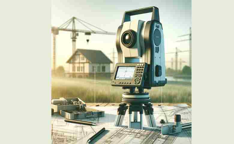
A total station is an integrated surveying instrument that combines the functions of an electronic theodolite, an electronic distance measurement (EDM) device, and a microprocessor. This powerful combination makes it possible to capture accurate angular measurements, distances, and elevations—all critical data points for successful surveying projects.
Key Functions of a Total Station:
- Angle Measurement: Determines precise horizontal and vertical angles.
- Distance Measurement: Uses laser or infrared technology to measure distances accurately.
- Elevation Determination: Calculates the relative heights of points, essential for topographic surveys.
Modern total stations are also engineered with advanced features like real-time kinematic (RTK) positioning, robotic control, and even 3D scanning capabilities to ensure accuracy and efficiency in field operations.
A total station is an electronic theodolite that measures angles and distances between points. It’s the most advanced surveying instrument today, capable of measuring horizontal and vertical angles to ±3 seconds.
A total station has two associated devices used during surveying: a digital distance meter which measures distance, and an angle sensor or right-angle optical prism, which measures the horizontal or vertical angle.
Like the word “total” means, this instrument can do many measurements; a Total Station is a telescope mounted on wheels or a tripod. It can measure distances and angles between lines, heights of points on an object, area and volume of an object from its sides, slope angle between two directions on the ground, etc.
If you want to learn about Total Station, we highly recommend downloading the Total Station Tutor App.
- Apple AppStore Link: Click here to download
- Google Play Store Link: Click here to download
Types of Surveying Instruments
A survey instrument measures properties such as landmass, angles, and elevations, which are not measured by the naked eye.
It provides information in the form of two mathematical expressions for any location. Consequently, this information can be integrated with existing or future data to provide new insights into each location’s features.
Surveying instruments are classified as instruments for land surveying or engineering. Land surveying instruments measure distances and elevations on the ground and may also measure horizontal angles.
Related Posts:
- What is Civil Engineering Surveying?
- The Best Quantity Surveying Institute In India [ Updated List]
- Top 10 Quantity Surveying Software [ Updated List]
- Top Online Courses on Quantity Surveying for
- Best Books for Advanced Surveying for Students and Engineers
Engineering instruments typically get straight vertical or horizontal lines from a starting point to wherever you are constructing or drawing the object being surveyed:
Other types of surveying instruments include the laser rangefinder, a device that distances the surface of reflective objects. Total stations are turning out to be a crucial component in these mechanisms because they provide accurate measurements with consistent margins of error.
The related surveying instruments include Total Stations, Surveyor’s Benchshocks, Precision “odometers” or Flowmeter Tanks, and Surveying Laser Rangefinders or Messmarkers. You can install these instruments virtually anywhere on your property, such as domestic size areas like a house.
How does Total Station Work?
Total stations are used in surveying and mapping. A total station is a series of coordinated gunsights, telescopes, convergence sights, inclinometers, periodic dials, and a compass that allows the rapid collection and transfer of bearing measurements by connecting to the data link port of a GPS receiver.
Trimble SX12 technical specifications
Surveying is a modern type of remote sensing, which uses technology to transmit data from space. It is used primarily for building surveys and map-making.
Total stations are devices that can be set up on the ground and measure distances, angles, areas, heights, slopes and locate objects using multiple sensors.
The accuracy and resolution of these measurements depend significantly on the quality of the equipment used in surveying. Today calculating points on an aerial LiDAR scan coincides with today’s most reliable point of view.
In 1881 Thomas Edison introduced the first total station still in use today at Colgate University in Hamilton, New York. Due to its economic efficiency, a total station has become famous throughout commercial building surveying uses nowadays.
A total station combines an instrument and software that uses spatial understanding to determine position data. Sources can include multiple sensors such as a Global Positioning System receiver, triangulation, or limited range radio communications.
For surveying, total stations are used in action taking and photogrammetry to take precision measurements, such as angles and distances of objects. This allows their images to be captured digitally. Another use is measuring crop yield and determining the type of crop.
Total stations can measure long distances up to 8 miles depending on the equipment they have been equipped with.
A total station is a surveying instrument that uses the data generated by radar and digital receivers to provide both distance and height measurements over a land survey. They are used with GPS precision in a vertical position, horizontal distance, and angular geometry.
In a surveyor’s profession, the need for surveyors to obtain proper coordinates is an STI constantly needed. Assisted by laser-light scanning and known as total stations, this is not a job for amateurs or hobbyists.
The use and applications of total-station surveys are vast, with many fields choosing to use them for various operations depending on personal preference.
Working principle of the total station in surveying
The entire station allows surveyors to create a map of a spot in three instead of two dimensions, as was generally the case with surveying instruments.
The term 1–Point reflects this capability; each point that a full surveying method measures is considered one dimension and describes an independent position on the ground. A total station has high accuracy and range due to its lenses, adjustable vertical laser levels, and bubble axes.
A total station is a tool used for surveying. The equipment heavily relies on geo-radar and time signals to calculate the levels and distances of points it is set over.
The measurement of heights or portions of objects is done by the prism used to determine the angles partaking in triangulation and rapid positioning.
The application of the total station in surveying covers a vast range of activities related to engineering and construction.
The total station is used in various industries, such as civil engineering, architecture, construction site engineering, traffic engineering, and airport design. Additionally, it is also used in transportation management systems.
Types of total station
For total surveying stations, there are different types of full stations. The most popular form is a total handheld station, available with an internal or external antenna and for photogrammetric processing.
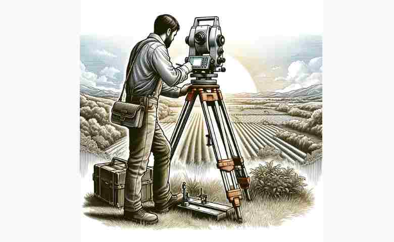
Another type is the mobile station attached to a motorized platform that gives it mobility. Lastly, the fixed station is mounted on a tripod and provides continuous service from a stationary point.
As per Trimble Geospatial, there are the following four types of Total Stations;
1. Scanning Total Stations

Scanning Total Stations are a hybrid surveying instrument that combines the capabilities of a traditional total station with laser scanning technology. This integration allows for high-speed, high-density 3D data collection, making it ideal for detailed topographic surveys, as-built documentation, and forensic analysis. Scanning Total Stations enable surveyors to capture a comprehensive digital representation of a site or structure quickly and with precise detail, facilitating efficient data analysis and modeling for various applications.
2. Robotic Total Stations

Robotic Total Stations (RTS) represent a significant advancement in surveying technology, combining the functionalities of traditional total stations with automation and precision. These sophisticated instruments are designed to automate the data collection process, allowing for single-operator use where the device automatically follows the target, records data, and transmits it in real-time. The integration of robotics into total stations enhances efficiency, reduces the need for manual intervention, and significantly increases accuracy in capturing spatial data.
One of the key features of Robotic Total Stations is their ability to operate remotely, which not only speeds up the surveying process but also ensures safety in challenging or hazardous environments. With advanced tracking capabilities, an RTS can maintain a lock on a moving prism, facilitating dynamic surveying tasks and complex measurements without the constant need for manual adjustment.
The use of Robotic Total Stations is widespread across various fields including construction, engineering, and geospatial studies. They are particularly valued for their role in building information modeling (BIM), topographic surveying, and infrastructure projects, where precision and reliability are paramount. The automation provided by RTS systems also opens up opportunities for integrating with other technologies like GPS and GIS, offering comprehensive solutions for spatial analysis and mapping.
In essence, Robotic Total Stations have revolutionized the surveying industry by providing a blend of accuracy, efficiency, and flexibility. They embody the cutting edge of surveying technology, enabling professionals to achieve more with less effort and in less time, thereby setting new standards in the accuracy and management of spatial data.
3. Autolock Total Stations

Autolock Total Stations feature technology designed to automatically identify and lock onto a reflective target, streamlining the surveying process by reducing the need for manual intervention. This autolock capability enhances productivity and accuracy, as the instrument can swiftly adjust to the target’s movements, ensuring continuous, precise measurements. Ideal for projects requiring frequent repositioning or tracking of a moving target, Autolock Total Stations offer a balance of convenience and precision, making them a valuable tool for construction, engineering, and geodetic surveys.
4. Total Mechanical Stations

Total Mechanical Stations are the foundational tools in surveying, relying on manual operation for measuring angles and distances. Despite the advent of more technologically advanced stations, Total Mechanical Stations remain valuable for their reliability, durability, and precision. They require a skilled operator to manually align, aim, and measure, offering a hands-on approach to surveying. Total Mechanical Stations are often used in educational settings, basic site surveys, and where the conditions or project requirements do not necessitate the advanced features of robotic or scanning total stations.
Instrument manufacturers
- Carl Zeiss (historical)
- GeoMax, part of Hexagon AB
- Hewlett Packard (historical)
- Nikon, part of Trimble
- Leica Geosystems, part of Hexagon AB
- North Group LTD (historical)
- Sokkia, part of Topcon
- TI Asahi Co. Ltd, sold under the Pentax brand
- Topcon
- Trimble Navigation Ltd.
- Wild Heerbrugg AG (historical), part of Leica Geosystems
Total station in Surveying
A total station in surveying is an inventory and control device used to take your measurements digitally. The data collected by a total station is displayed on a control unit, controlling its elements utilizing software and technology.
Total stations are only to be used by trained people who know to be safely used in construction sites or at the workplace where they understand what the use may bring.
Related Posts
- Join Total Station, Surveying, and Mapping online course
- Top Trending Online Courses for you [ Updated]
- Top 10 Most Popular Free Online Business Courses For
- AutoCAD vs. SOLIDWORKS: which CAD software is right for you?
Key Uses and Applications of Total Stations
Total stations cater to a wide array of industries and project types. Below are some of the main areas where they are making a significant impact in 2025:
A. Construction and Civil Engineering
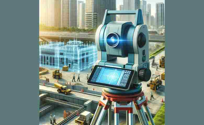
- Site Layout and Staking: Total stations are pivotal in marking out building footprints, roads, and utilities with pinpoint accuracy.
- Quality Control: The ability to verify measurements in real time ensures that structures are built according to design specifications.
- BIM Integration: Many modern total stations integrate with BIM software, enabling seamless sharing of survey data during project planning and execution.
B. Topographic and Land Surveys
- Mapping Terrain: Detailed topographic surveys rely on the high precision of total stations to capture natural features and man-made structures.
- Monitoring Land Deformation: They are essential in regions with active geological movements, ensuring that any changes in the terrain are accurately recorded.
C. Mining and Environmental Surveys
- Resource Estimation: Reflectorless and robotic total stations help in calculating mineral reserves with greater accuracy.
- Environmental Impact Assessments: Total stations facilitate data collection in environments that are difficult to access, reducing the need for physical measurements.
D. Infrastructure and Urban Planning
- Smart City Developments: Integrating total station data with GIS systems plays a critical role in planning and managing urban infrastructures.
- Utility Mapping: They are vital for mapping underground and overground utilities, ensuring efficient city planning and maintenance.
The most widely used survey instruments in surveying are total stations and paired wire leveled distance measuring equipment.
Surveying instruments provide an accurate understanding of any property, boundaries, and vegetation, making land surveying the backbone of real estate, engineering, and other disciplines. Due to their ease of use, these surveying systems are typically called ‘stations.’
A surveyor can use a total station to measure distance, level, angle, and elevation in a given site. The total station is an instrument used to determine horizontal and vertical datums in a given area. These instruments can be sized to the field of survey, with options ranging from hand-held devices for general purpose usage to large mobile total stations usually used for long-term surveying or construction.
A total station is a device used by surveying experts to map heights and distances. It consists of a telescope, Vernier scales, and a coordinate system that helps in calculating the relative vertical location. The most common types used are the company’s brand total stations, transit total stations, and handheld ones.
Related Posts:
- Free Online Surveying Subject Practice and Preparation Test
- Reasons to Hire a Long-Distance Moving Company
- Textbooks and Reference Books for Advanced Surveying
- 5 Unmissable Perks of Using Drones during Construction
Customer Benefits of using a total station
Thanks to technology advancements, many customer benefits are now included in surveying using a total station. One advantage is creating contour maps by simple measurements and calculations.
Another benefit is it saves surveys time since they need not go through the tedious process of measuring distances and angles more than once. Surveys can also use processes like detailing that improve accuracy and eliminate errors from the survey process.
Customers benefit from the many features of total stations, such as data capturing and analysis. These features allow businesses to take advantage of flawless and accurate survey collecting, providing significant cost savings while increasing the likelihood of getting accurate information.
When a customer starts using a total station for the first time, such as when setting up aerial photography, he is usually confused about how to carry it.
To answer this question and make his work go more smoothly and efficiently, he should first figure out the weight of the total station according to hardware weight, net weight, and volume capacity of goods that it enters.
How to Choose the Right Total Station for Your Project
Choosing the best total station for your needs involves considering several factors:
Project Scale: Large projects might benefit from robotic or hybrid total stations due to their speed and automation capabilities.
Accuracy Requirements: Projects demanding high precision should opt for instruments with advanced RTK and 3D scanning capabilities.
Operational Environment: Consider reflectorless models if your survey area includes challenging or hazardous terrain.
Budget Constraints: Manual total stations can be cost-effective for smaller projects, whereas high-end models provide additional features that justify their higher price.
Future-Proofing Your Investment: Look for models that support software updates and integrate with the latest digital workflows, ensuring longevity and versatility.
Latest Trends in Total Station Surveying for 2025
The surveying industry is on the brink of a technological revolution. Here are some of the emerging trends that are shaping total station surveying today:
- Integration with Drones and UAVs: Combining data from aerial surveys with ground-based total station measurements for comprehensive site assessments.
- Augmented Reality (AR) Applications: Using AR glasses to visualize survey data directly on-site, enhancing real-time decision-making.
- Enhanced Sustainability: New designs focus on energy efficiency and longer battery life, catering to remote and off-grid locations.
- Cloud-Based Data Management: Cloud integration enables real-time data sharing and collaboration, ensuring that all team members have access to the latest survey data.
- Artificial Intelligence (AI) and Automation: AI-driven analytics help in processing large datasets, improving precision, and forecasting potential issues before they arise.
Final Thoughts
The Total Station survey PDF is a comprehensive guide for professionals and students in the surveying field, offering detailed insights into the operation, application, and benefits of using total stations. This document covers the types of total stations in surveying, showcasing the diversity in technology and capabilities available to suit different project needs. Understanding how to use total station in surveying is crucial for accurate data collection and analysis, and the PDF provides step-by-step instructions, ensuring that users can maximize the efficiency and precision of their surveys.
The total station price varies depending on the model, features, and manufacturer, making it important for surveyors to balance cost with the specific requirements of their work. Learning how to use total station effectively can significantly enhance the quality of surveying work, making it a valuable skill for professionals in the field. The importance of total station in surveying cannot be overstated, as it revolutionizes how measurements are taken and analyzed, offering unparalleled accuracy and efficiency.
Total station drawing capabilities further extend its utility, enabling the direct transfer of measured data to digital maps and plans. When comparing total station vs theodolite, it becomes evident that total stations offer more advanced features, including electronic distance measurement and data storage, making them the preferred choice for modern surveying tasks. The total station survey instrument is designed with the working principle of total station in surveying at its core, integrating electronic distance measurement with angle measurement to provide comprehensive data on a single platform.
Various types of total stations cater to different surveying needs, with each total station diagram illustrating the sophisticated integration of technology that allows for such versatility. The term “theodite” is often a misnomer for theodolite, a traditional surveying instrument largely superseded by the advanced functionalities of total stations.
Total stations have become indispensable in surveying, offering a range of functionalities that significantly improve the accuracy and efficiency of measurements. From detailed guides like the total station survey PDF to the practical application of these instruments in the field, it’s clear that mastering the use of total stations is key to achieving high-quality surveying results. Whether it’s through understanding the working principles, comparing different types, or utilizing their advanced drawing capabilities, the depth of knowledge and expertise in total stations can profoundly impact the success of surveying projects.
It is a powerful tool construction engineers use to plan land and in construction-related tasks such as earthworks, grading, leveling, and shape planning. It has been around since 1967 when engineer Robert Livesay created it to design cut lines for constructing drill sites and roads.
This incredible device is taking surveying to the next level. It has changed the landscape of survey technology, and once again, these instruments are catching up with cutting-edge technology even before it is introduced on a larger scale.
Related Posts:
- Exploring Various Types of Surveying in Civil Engineering
- The Difference Between Surveying and Quantity Surveying
Total Station FAQs
A total station is used for surveying and construction. They are also used in aviation, agriculture, geology, archaeology, forestry, and photography. Total stations have many other uses, such as engineering surveys and navigation.
The principle of the total station is that it has no moving parts. This is because it uses electronic distance measurement technology. The GPS and laser usually come with a dual-beam total station. The most common types are the single-beam (sometimes called a PEGASUS) and the dual-beam.
The total station is the most common surveying instrument and the primary tool for all surveying levels. It is used to find or measure angles, distances, heights, and other spatial information. The EDM (electronic distance measurement) can also be attached to a total station, or it can be a stand-alone device as well. The EDM uses GPS technology to determine distances from one point to another on earth with greater accuracy than any stand-alone surveying instrument today.
Essential equipment for total station surveying includes the total station itself, a tripod to mount the station, a prism or reflective target, and data storage or transfer devices. Additional tools may include batteries for power, a range pole, and software for data analysis and project planning.
In survey terminology, a total station is an electronic/optical instrument used for measuring angles and distances. It integrates the functions of a theodolite for angle measurement and an electronic distance meter (EDM) for distance measurement, facilitating data collection for mapping, construction, and navigation.
The primary difference between a theodolite and a total station lies in their functionality. A theodolite measures horizontal and vertical angles, while a total station combines the capabilities of a theodolite with an electronic distance meter (EDM) to measure angles, distances, and coordinates, offering more comprehensive surveying capabilities.
The two main types of total stations are manual and robotic. Manual total stations require an operator to manually aim the instrument at a target, whereas robotic total stations can automatically track a moving target, allowing for single-operator use and increased efficiency in data collection.
Instruments used in cadastral surveying include traditional tools like tape measures and chains for basic measurements, theodolites for angle measurements, and modern equipment such as GPS units for precise positioning, and total stations for comprehensive distance and angle data collection, ensuring accurate boundary and land parcel delineation.
Advancements in total station technology include the integration of GPS for precise positioning, enhanced data processing capabilities, wireless connectivity for data transfer, and the development of software applications for real-time data analysis and project management, significantly improving survey accuracy and efficiency.


